- USD 9.99
- View more offers at FS Addon Compare
- Added: June 11, 2026
- Updated: July 1, 2026
Bonus: on purchase is included the MSFS 2020 and 2024 version of the item
ADVANCED VFR – PATAGONIA
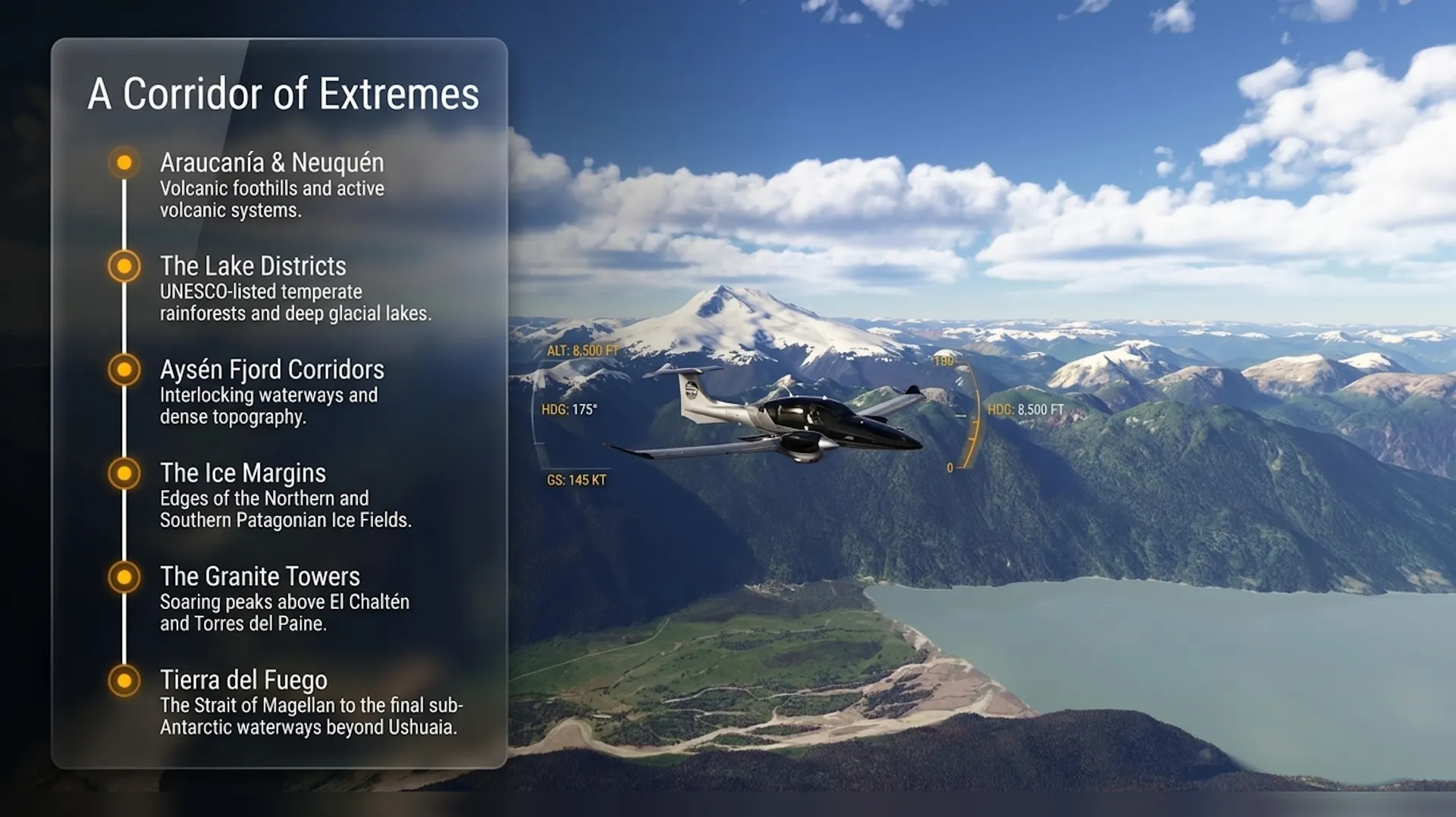
The corridor along the Chile-Argentina border from the Araucanía to Tierra del Fuego contains an extraordinary concentration of volcanic terrain, glacial lake districts, temperate rainforest, open steppe, fjords, ice fields, and sub-Antarctic channels. This package follows that corridor from north to south across the full length of Patagonia.
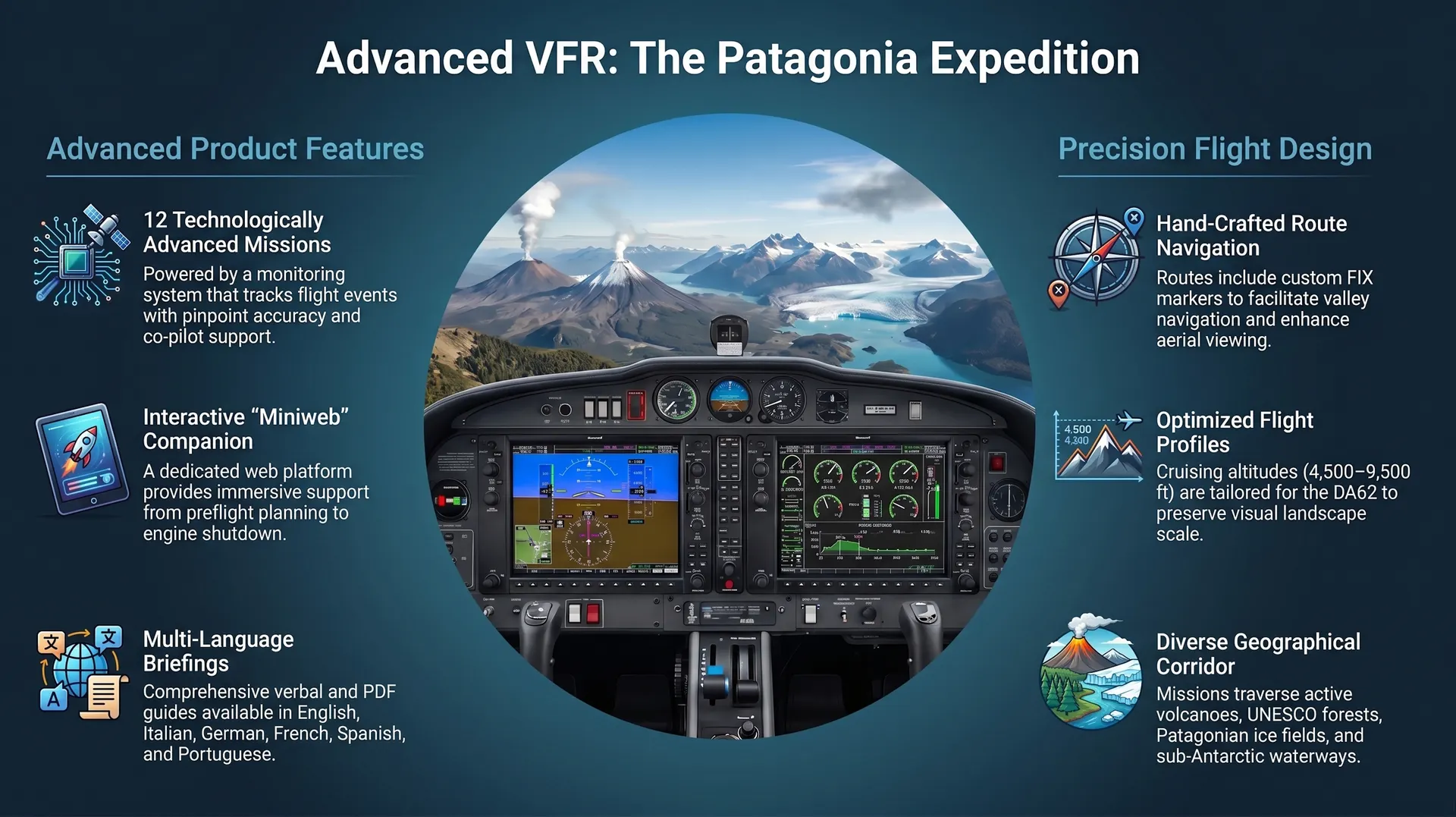
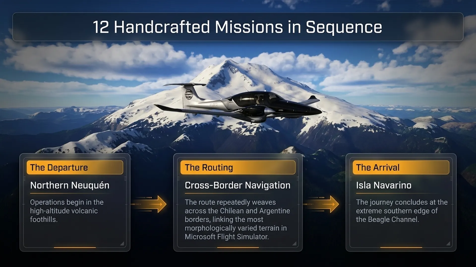
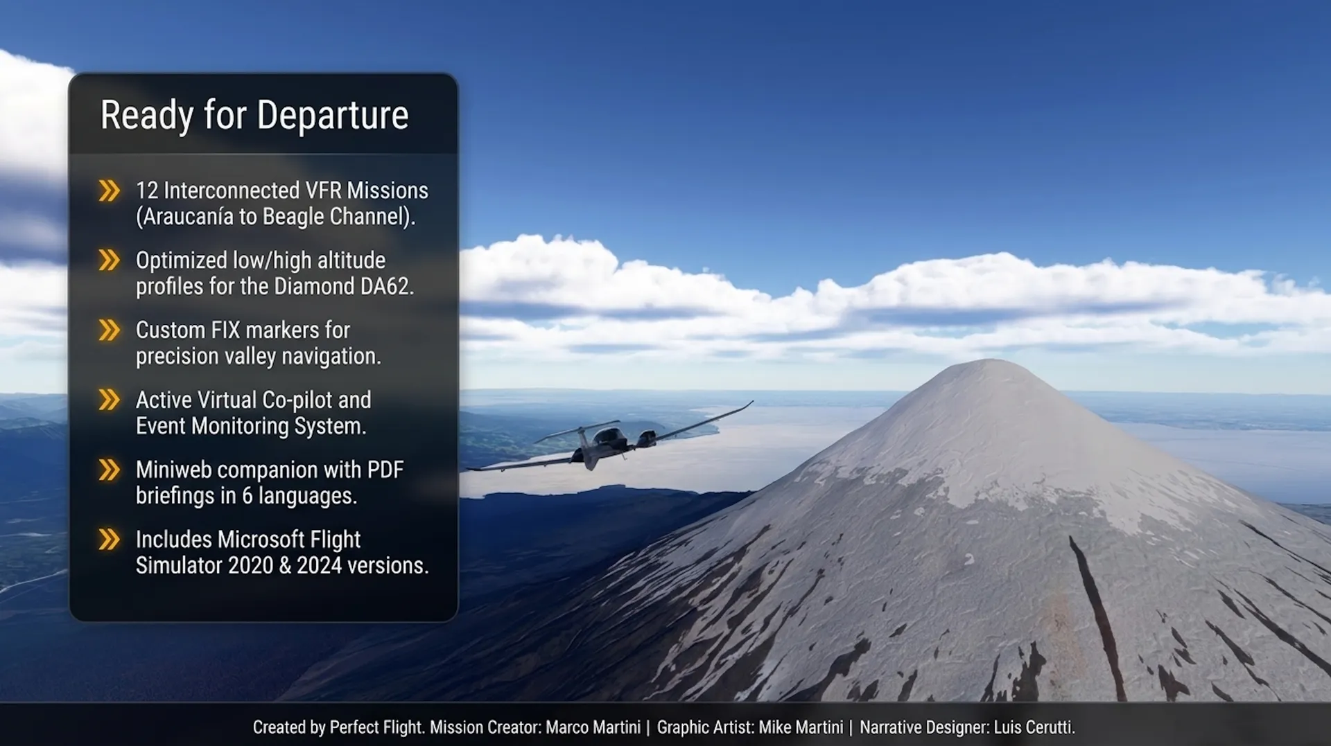
Twelve VFR missions cover the entire area in sequence, beginning in the volcanic foothills of northern Neuquén and ending on Isla Navarino at the southern edge of the Beagle Channel. The route repeatedly crosses the Chilean and Argentine border and links together some of the most morphologically varied terrain available anywhere in Microsoft Flight Simulator.
Along the way, the tour passes: ■ Volcanic Systems: The tour begins in the volcanic foothills of northern Neuquén and passes through several active volcanic systems;
■ Glacial Lakes and Forests: You will fly over UNESCO-listed forest and lake country, as well as temperate rainforests;
■ Ice Fields and Glaciers: The route takes you along the margins of both the Northern and Southern Patagonian Ice Fields;
■ Granite Towers: You will encounter the world-famous granite towers rising above El Chaltén and Torres del Paine;
■ Fjords and Waterways: The journey traverses the fjord corridors of Aysén and the Strait of Magellan;
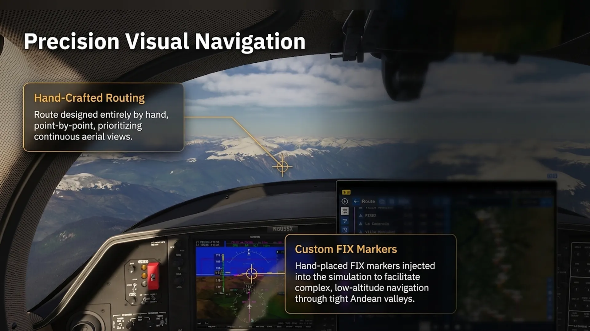
■ Steppe and Valleys: The terrain includes the wide-open Magallanic steppe and deep valleys that have been specifically marked with FIX markers to facilitate navigation through the complex mountain geography;
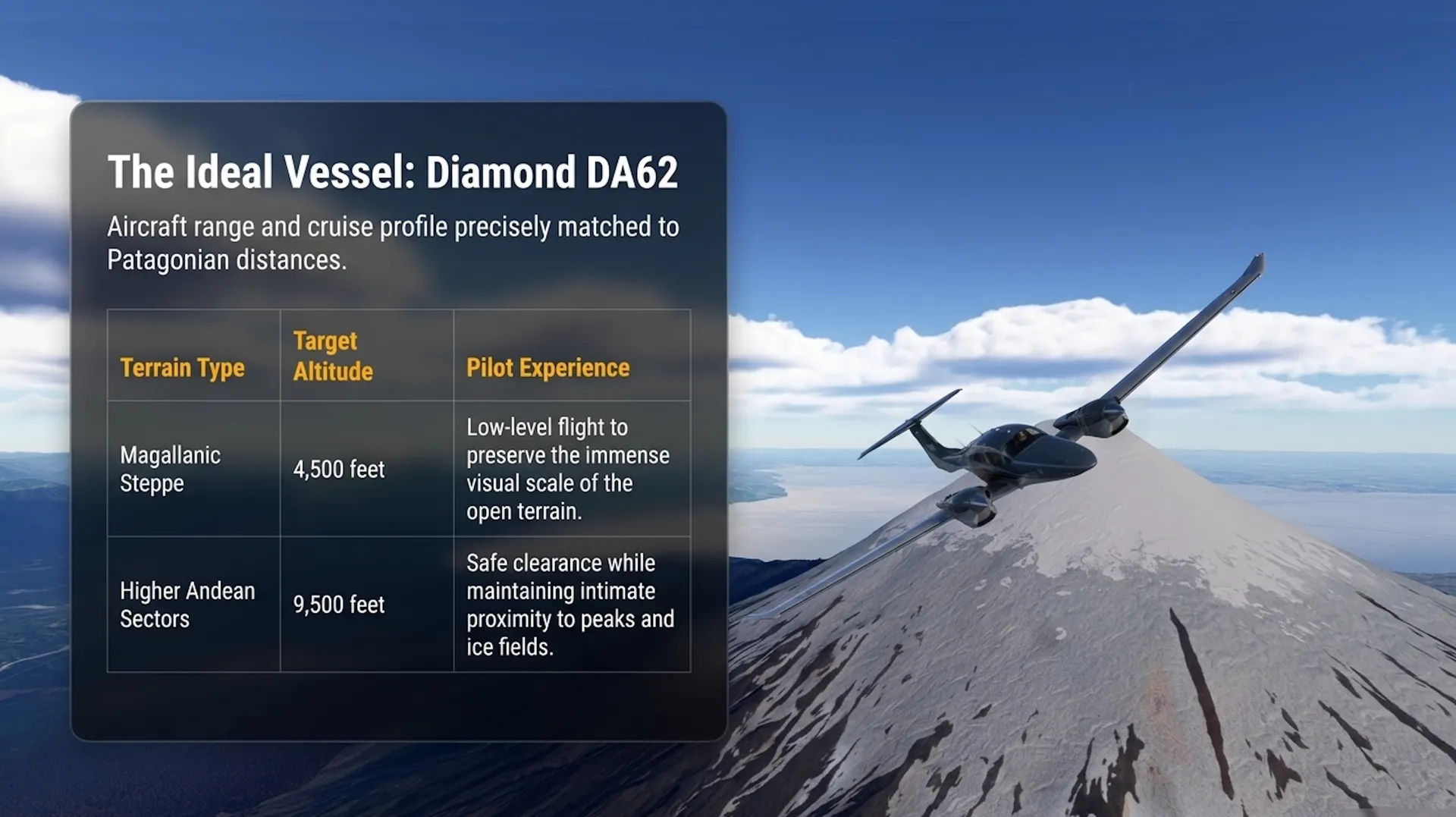
The DA62 is especially well suited to this itinerary. Its range and cruise profile fit the distances involved, while the mission design keeps the flight low enough to preserve the visual scale of the landscape, with cruising altitudes ranging from 4,500 feet over the Magallanic steppe to 9,500 feet through the higher Andean sectors.
The following elements contribute to a realistic VFR experience: ■ Hand-Crafted Route Design: The routes were designed "point by point". This includes the strategic placement of FIX markers to help you navigate through complex valley systems and improve the overall aerial view;
■ Altitude Management for Visual Scale: To maintain a realistic sense of speed and landscape detail, missions are designed to keep the flight relatively low Cruising altitudes are varied based on terrain, ranging from 4,500 feet over the Magallanic steppe to 9,500 feet through higher Andean sectors;
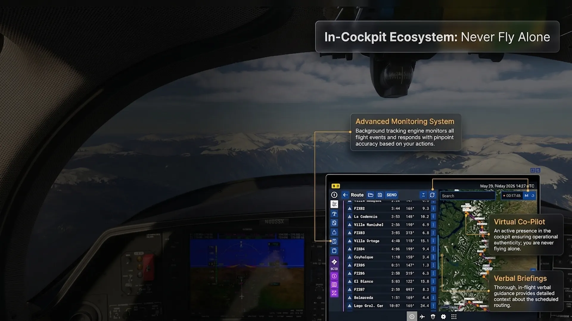
■ Advanced Flight Monitoring and Support: While navigation is entirely visual, the missions are powered by an advanced monitoring system that tracks flight events with precision. Additionally, a virtual Co-pilot is provided to assist you, simulating a multi-crew environment;
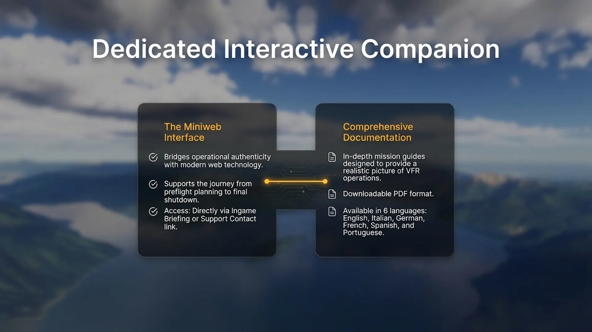
■ Professional Briefings and Docs: Each mission includes a thorough verbal briefing designed to give you an authentic picture of VFR operations. These are supplemented by downloadable PDF briefings available in multiple languages, including English, Italian, German, French, Spanish, and Portuguese;
■ Interactive Mission Companion: Realism is further extended outside the cockpit via a dedicated "Miniweb" interactive website. This tool supports the entire operational cycle from preflight to shutdown, combining modern web technology with aviation authenticity to simulate real-world pilot preparation and execution
- -> Use the Support Contact link or the Ingame Briefing to access the Mini Website
© 2026, Perfect Flight
Credits: Mission Creator: Marco Martini Graphic Artist: Mike Martini Narrative Designer: Luis Cerutti