- USD 21.99
- View more offers at FS Addon Compare
- Added: June 17, 2024
- Updated: July 15, 2024
Santorini (officially Thira) is a Greek island in the southern Aegean Sea, about 200km from Greek mainland. It belongs to the Cyclades group of islands, being the southernmost member of it. It covers an area of ~ 73km2.
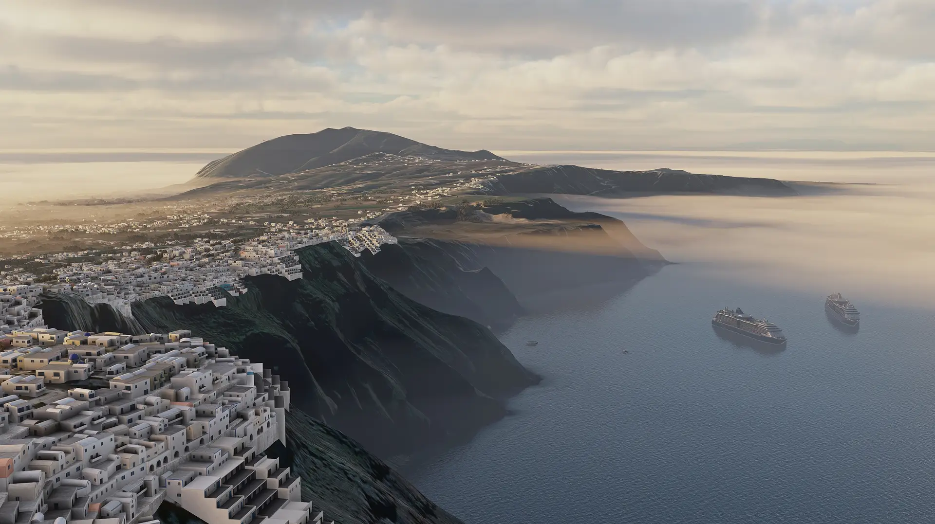
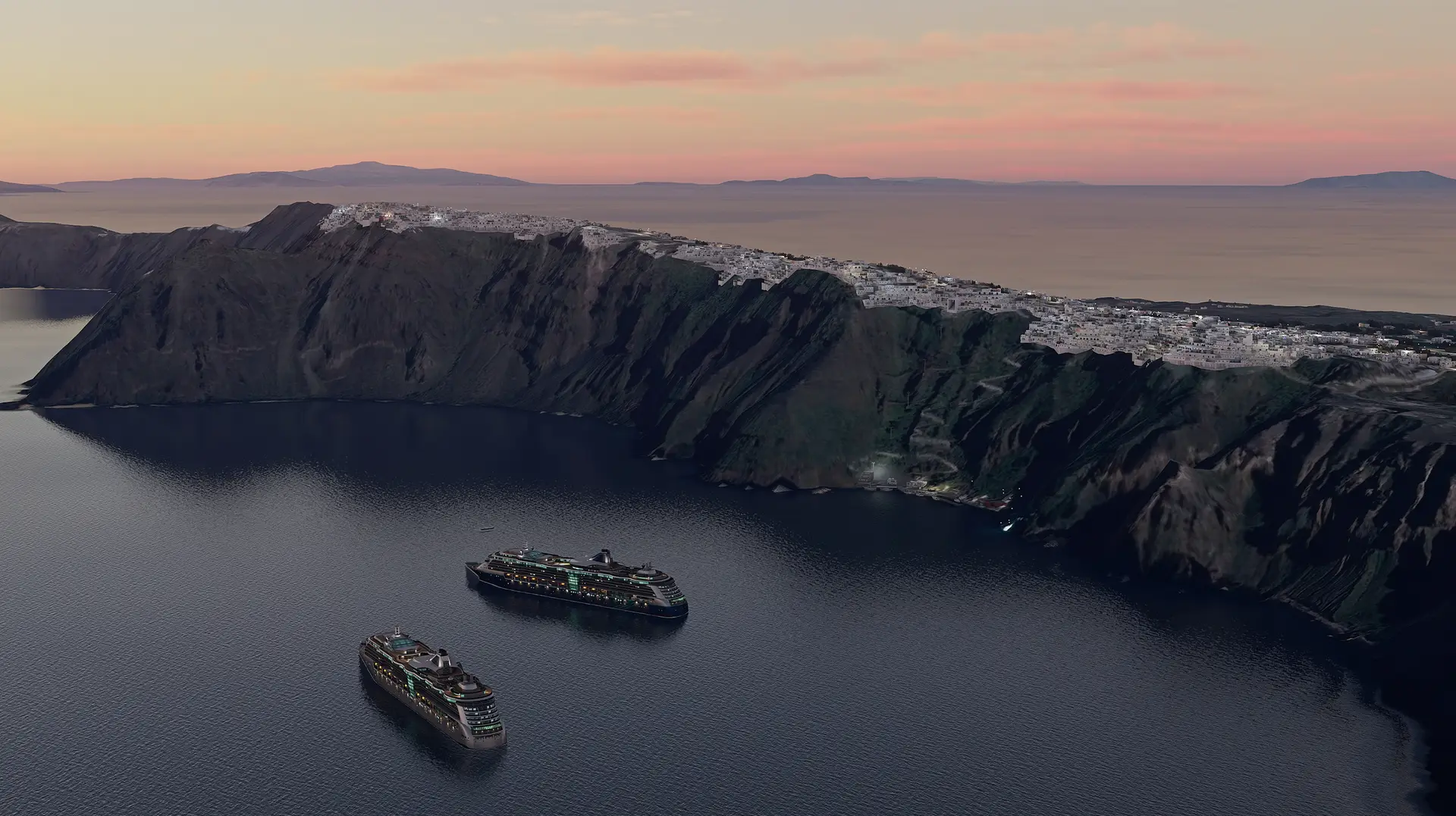
Santorini was the site of one of the largest volcanic eruptions in recorded history, which occurred approximately 3.600 years ago. The eruption created a large caldera in the middle of the circle, surrounded by volcanic ash deposits and sea.
A number of Santorini’s villages are built on the edge of the 400 meters high caldera, found on the western side of the semi-circular island. This gives the island a world-renowned landscape.
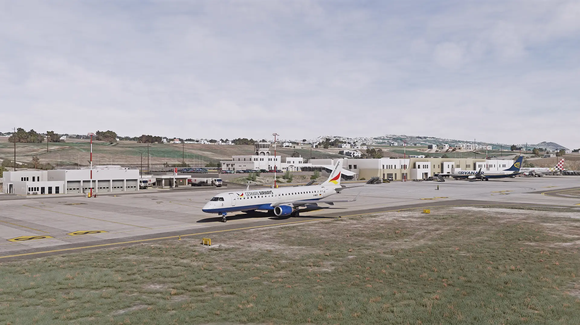
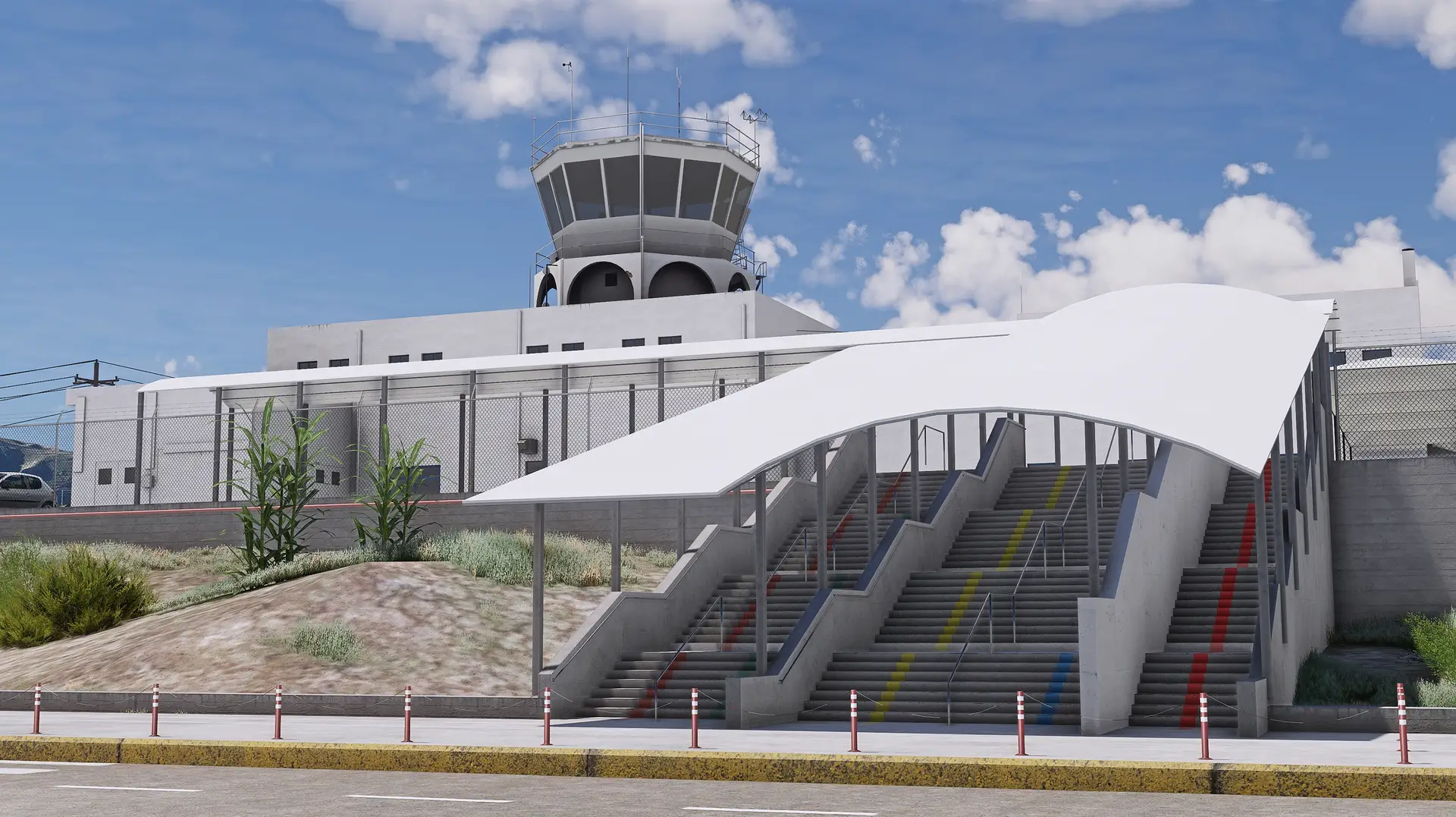
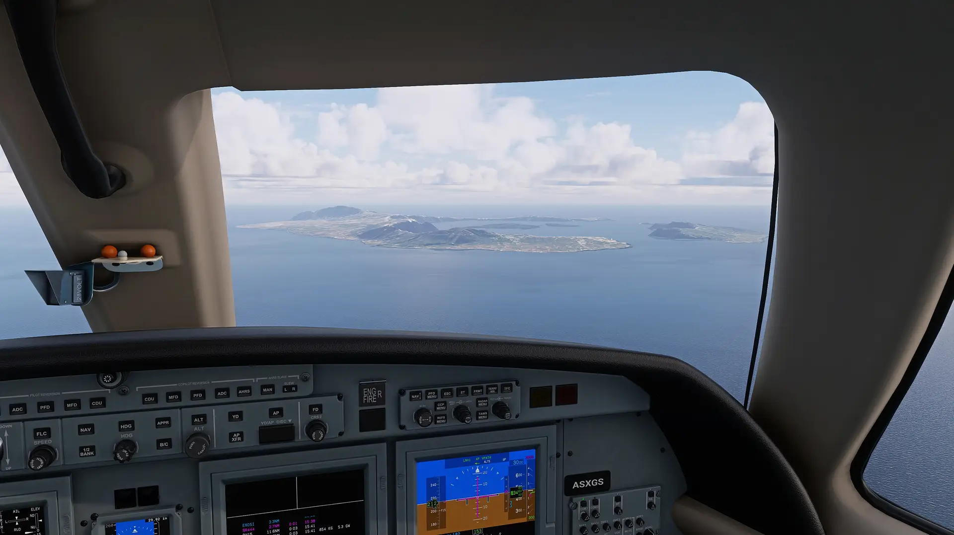
The Airport Santorini airport (IATA:JTR, ICAO:LGSR) is located at the southeastern side of the island, close to Kamari village. It is both a Civilian and Military airport, however the military activity is very little. The airport first operated in 1972.
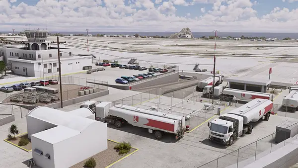
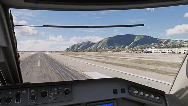
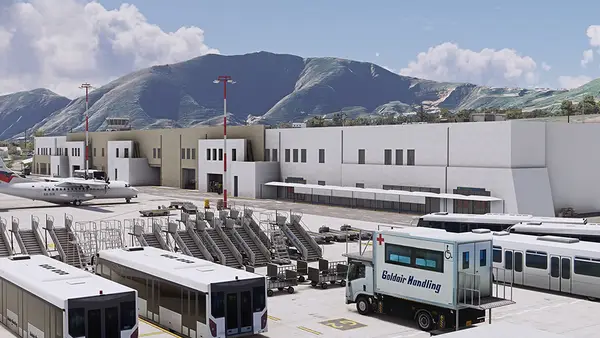
It has a main asphalt runway (15/33) which is 7,208 feet (2,197 m) in length and (only) 30m in width. The parallel taxiway was built and marked to runway specification but is now marked and lighted as a taxiway. The airport can accommodate medium-sized jets like the Boeing 757, Boeing 737 and Airbus A320 series as well as smaller aircraft such as ATR 42/72, Dash 8, AvroRJ and Fokker 70/100 on an apron that is connected to the taxiway with three intersections.
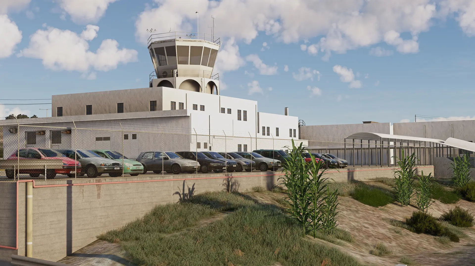
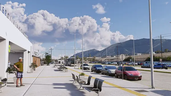
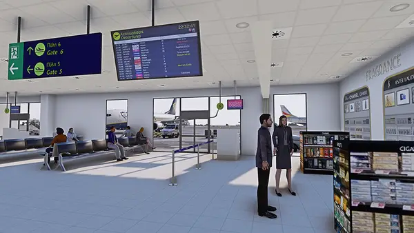
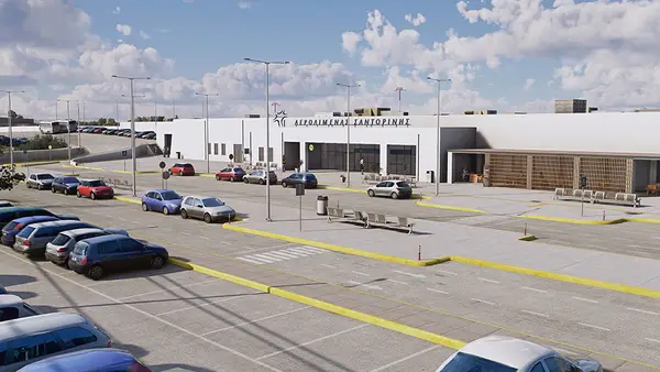
The terminal and apron were renovated and redesigned respectively in 2021 increasing the aircraft and passenger capacity of the airport. It can serve simultaneously up to nine airliners at respective parking positions.
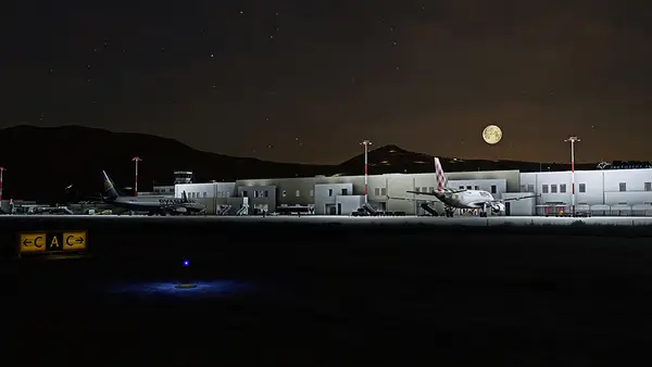
Airport Feature:
- The renovated Main Terminal building with its interior
- The new Fire Station
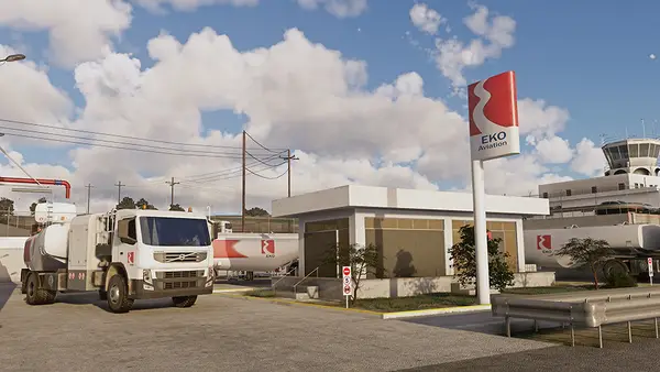
- The fuel facilities (EKO & GISSCO) in high detail
- The new apron layout with its relevant parking positions
- Highly detailed light poles, FOD bins, apron vehicles and other objects
- Highly detailed airport arrivals and departures parking area
- Custom windsocks, antennas, VOR, taxi and runway signs, taxi, and runway lights
- Two abandoned aircraft, close to the threshold of RWY 15
- Highly detailed military area including camouflaged shelters, buildings, contact cars and container boxes
- St Paraskevi’s church, a small church located on the south-eastern part of the airport, just outside its perimeter
- The whole airport area is illuminated with dynamic lights
Mesh Terrain The unique mesh terrain of the whole area (Santorini, Therasia, Palia Kameni, Nea Kameni, Aspronisi, Christiana) is represented in 3m/pixel resolution, significantly enhancing the immersion of the scene.
Vegetation All the trees of the island have been deleted. New ones have been placed to represent more accurately the intensity and type of real-life vegetation.
Buildings All the default buildings in all villages of the island have been deleted and replaced with custom ones, close to the Cycladic shape and color, including (and significantly enhancing) the four large villages built at the edge of Caldera (Fira, Firostefani, Imerovigli and Oia).
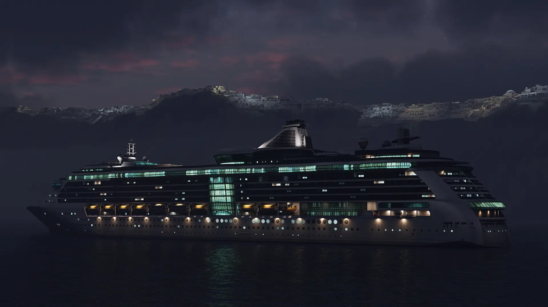
Ports The following ports of Santorini have been replaced with custom ones in the scenery: Ammoudi port in very high detail, Armeni port, Fira port, Athinios port (the main port of Santorini) in very high detail, Vlichada port and two small ports at the volcano island (Nea Kameni).
Points of Interest Oia Windmills, Fira Metropolitan Church of Ypapanti, Akrotiri Lighthouse, St John’s church and the respective hill at the eastern area of the airport.
Animations and AI vessels Traffic A large ferry is departing and arriving Athinios port, while two smaller animated boats, travel the route from Fira to Volcano Island’s respective ports and back. The real-life cable car that connects Fira port with Fira Village is also present and animated in the scenery.