- USD 4.99
- View more offers at FS Addon Compare
- Added: April 27, 2023
- Updated: July 24, 2026
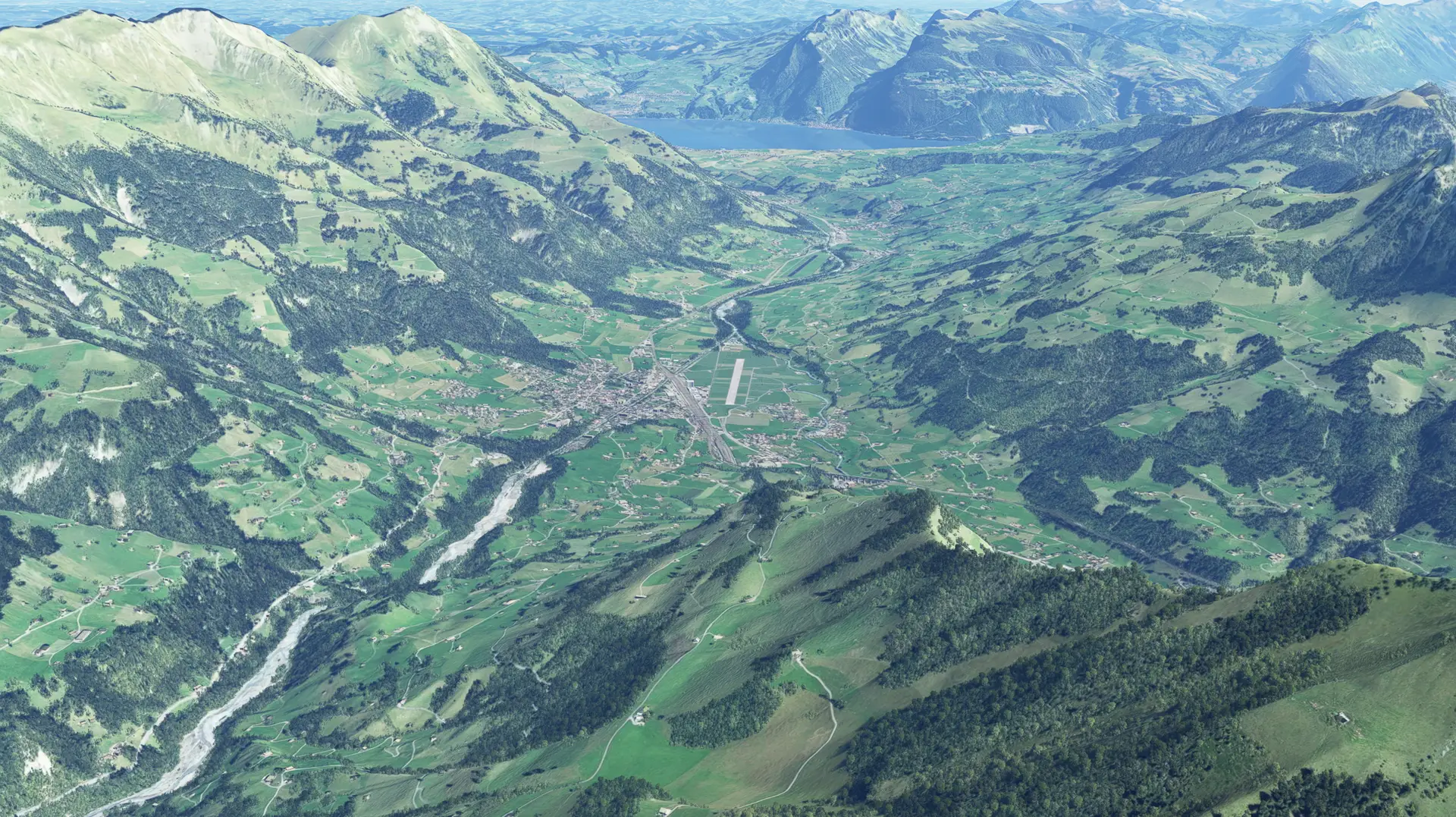
The perfect place to begin your Alpine expedition! From here, the flight takes less than 10 minutes to reach the four-thousand-meter peaks of the Bernese Alps and the longest alpine glacier, the Aletsch Glacier! Frutigen is also an ideal base for glacier flights.
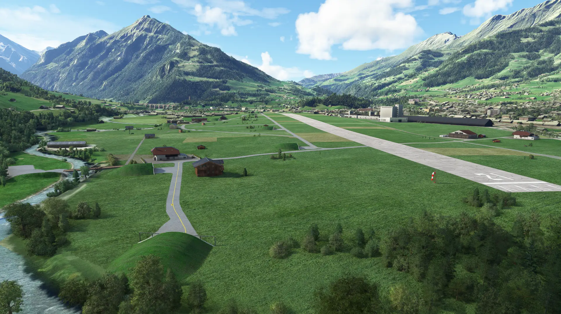
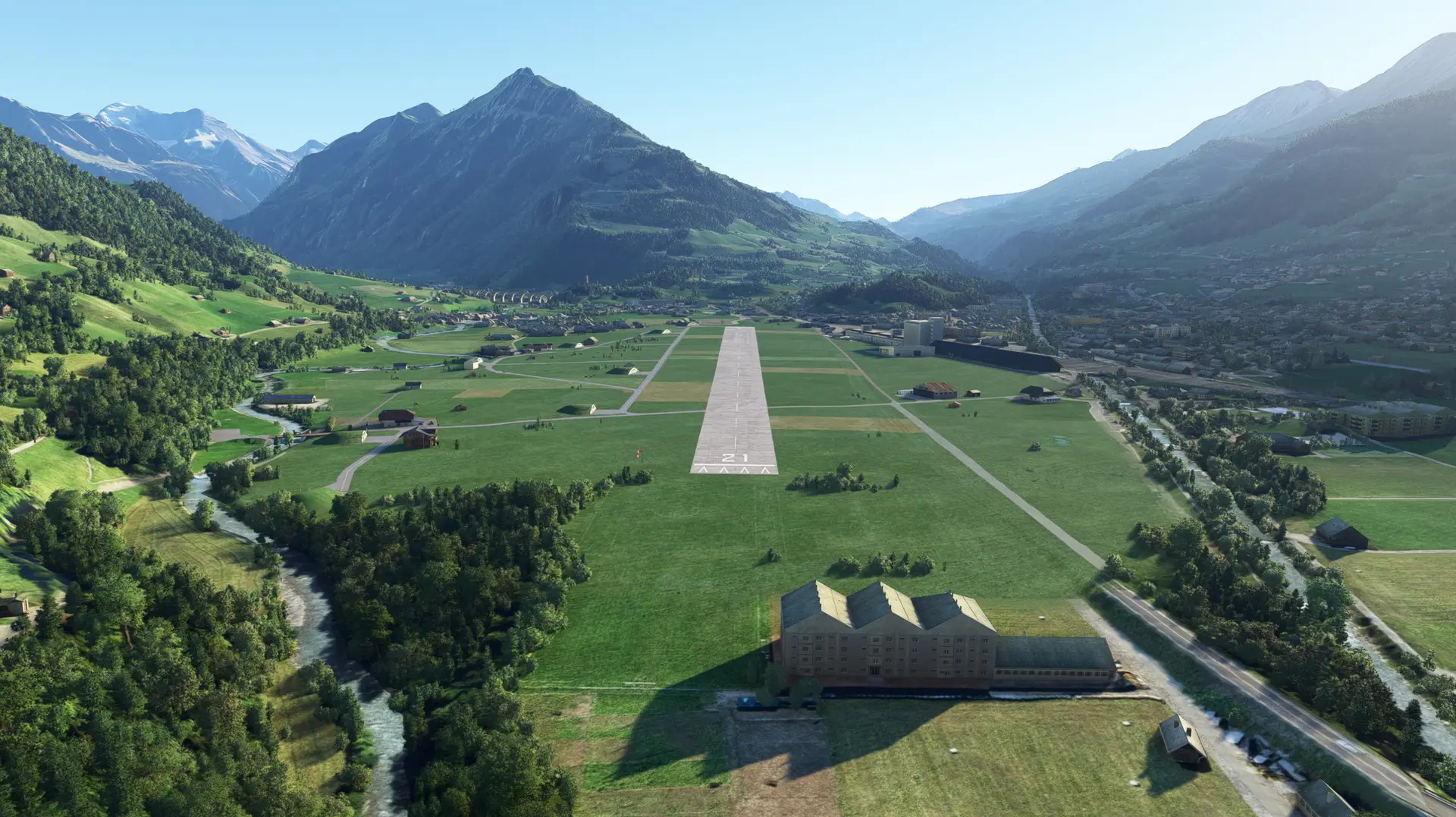
This scenery contains the military airport from Frutigen in its 1967 shape. Built during WWII, attempts to use it with fast jets in the 1950s were not fruitful (the runway is only 900m) so it remained in use by air transport units (which operated among other aircraft types the PC-6 and the JU-52). The airport was finally closed in 1997. So, if you would like to bring back a small piece of aviation history, this scenery is for you!
This scenery offers the following features:
- The scenery depicts a typical Swiss military airfield with public roads running across the airfield, farms located on the airfield grounds and cultivated hayfields.
- The runway is sloped and has 18m elevation difference.
- At the northeastern end of the airfield a wooden bridge was built over the Kander River, which allowed the aircraft to taxi to the maintenance facilities (shooting calibration range) at the eastern side of the river.
- The tall BLS rail service magazine at the western side of the airport is dominating the entire valley floor of the Kander Valley.
- Besides that, the infrastructure is not dense. Like the real airport, the scenery consists mainly of 8 U-43 shelters and a hangar.
- The iconic 265 m long Kander viaduct which is part of the northern ramp of the famous Lötschberg railroad enriches the landscape to the south.